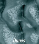
HiRISE, the High Resolution Imaging Science Experiment (they love their acronyms, and by golly they'll be good ones or the mission will fail), on board the MRO, is a survey mission of Mars to take high-resolution images of the surface. The applications of such a survey are far-reaching; the images allow scientists to see in detail the surface so they can analyze formations, surface excretions, polar caps, and vast amounts of geology things I don't know anything about.
But another important application of the imaging is the planning of robotic missions and follow-up. The camera has imaged enough of the surface that it has helped immensely in the choice of landing zones for Phoenix and MSL, and has even uncovered the remains of the previous Mars explorers, their parachutes and vehicles (some very covered with sand and sad-looking).
One neat story is that the landing site for Phoenix had looked smooth and hospitable in previous images, but HiRISE did a pass on it and showed that in fact it was full on huge boulders. A few months later, a more suitable site was found and Phoenix was thus saved from almost certain death.
Some images and a summary of the mission can be found here:
http://marsoweb.nas.nasa.gov/HiRISE/
It's a little eerie at times, seeing how earth-like the Martian terrain actually is...
No comments:
Post a Comment